 Connexion


 El Canal del Emperador (Alpes de Suisse Centrale)
Massif : Alpes de Suisse Centrale
Sommet : Chaiserstuel (2400 m)
Orientation : N
Dénivelé : 700 m.
Difficulté de montée : TD-
Difficulté ski : 4.3 E2
Pente : Max. 45°, mostly between 35° and 40°.
Sommet : Chaiserstuel (2400 m)
Orientation : N
Dénivelé : 700 m.
Difficulté de montée : TD-
Difficulté ski : 4.3 E2
Pente : Max. 45°, mostly between 35° and 40°.
 El Canal del Emperador is Chaiserstu's North couloir.
 Départ :
Oberrickenbach (Bannalpsee) (1587 m) - De Lucerne prendre la route de Engelberg, jusqu'à Wolfenschiessen (25 km), aller à Oberrichenbach, la prendre une Cabine pour Bannalp (1587).
Départ :
Oberrickenbach (Bannalpsee) (1587 m) - De Lucerne prendre la route de Engelberg, jusqu'à Wolfenschiessen (25 km), aller à Oberrichenbach, la prendre une Cabine pour Bannalp (1587). Itinéraire :
Park in Fell.
Itinéraire :
Park in Fell.Take the lift to Chrüshütte.
Follow the itinary to Chaiserstuel summit.
Go down to 2213 where you'll find a first anchor.
Traverse or rappel down then go up to the couloir entry.
Go down to 2213 where you'll find a first anchor.
Traverse or rappel down then go up to the couloir entry.
Matériel :
Rope (min. 25 meters), ice axe, crampons, harness, a few friends, stoppers and quickdraws or rappeling down equipment.
 Remarques
Explanations:
Fifty metres before the Chaiserstuel summit, descend 150 metres down the western face to a flat platform (altitude: 2,213m). From this platform, secure your skis to your backpack and climb 5–10 metres up to the first anchor. From here, you have two options:
- Abseil three pitches (20m, 25m, and 10m) into the alternative couloir, which you then ascend to reach an altitude of 2,229m. I have not done the abseils myself, so I cannot provide further details.
- Traverse (slightly exposed but protected by a few bolts). A spacing of 15–20 metres between climbers is reasonable. Use a selection of cams and nuts for additional protection. However, as the rock is crumbly, it is best to avoid falling. This traverse leads to an altitude of 2,229m.
- Traverse (slightly exposed but protected by a few bolts). A spacing of 15–20 metres between climbers is reasonable. Use a selection of cams and nuts for additional protection. However, as the rock is crumbly, it is best to avoid falling. This traverse leads to an altitude of 2,229m.
From 2,229m, reattach your skis and negotiate the couloir’s entry. The first section can feel somewhat precarious, but it quickly becomes more inviting. Take care through the initial narrow passage, followed by a second constriction between the rock walls. Depending on snow conditions, the passage may be as narrow as 1.5 metres. However, on the left wall, there is a bolt, allowing you to abseil if necessary.
Complete the descent by reaching the lift, either at an altitude of 1,640m (skins needed) or at 1,196m, the intermediate station.
Complete the descent by reaching the lift, either at an altitude of 1,640m (skins needed) or at 1,196m, the intermediate station.
Disclaimers:
The Outdoor Guide Engelberg classifies this couloir as “extreme skiing.” In our view, El Canal del Emperador serves as an introduction to steep skiing—though the skiing itself is not particularly exposed, the greatest challenge lies in the traverse. The route is classified in the guidebook as SS (Super Schwierig, Very Difficult).
This “topo guide” is, in my opinion, merely an outline. I do not consider myself experienced enough to write authoritative route descriptions, but given the scarcity of information on steep descents in this region, I would love to see more documentation come to light. I am actively seeking projects! If you believe any key details are missing, please comment, and I will update the guide with your contributions.
Questions:
Does anyone have further details on the abseils?
Has anyone skied the variant and would be willing to share additional information?
Are there any similar lines in the region that you would recommend?
I am very curious about the history behind the name—does anyone know more?
Voir aussi : Outdoor Guide Engelberg
www.alexanderryden.se/canal-del-emperador/
peaksix.ch/switzerland/canal-del-emperador/
www.baschibender.de/canal-del-emperador-video-fotoproduktion/
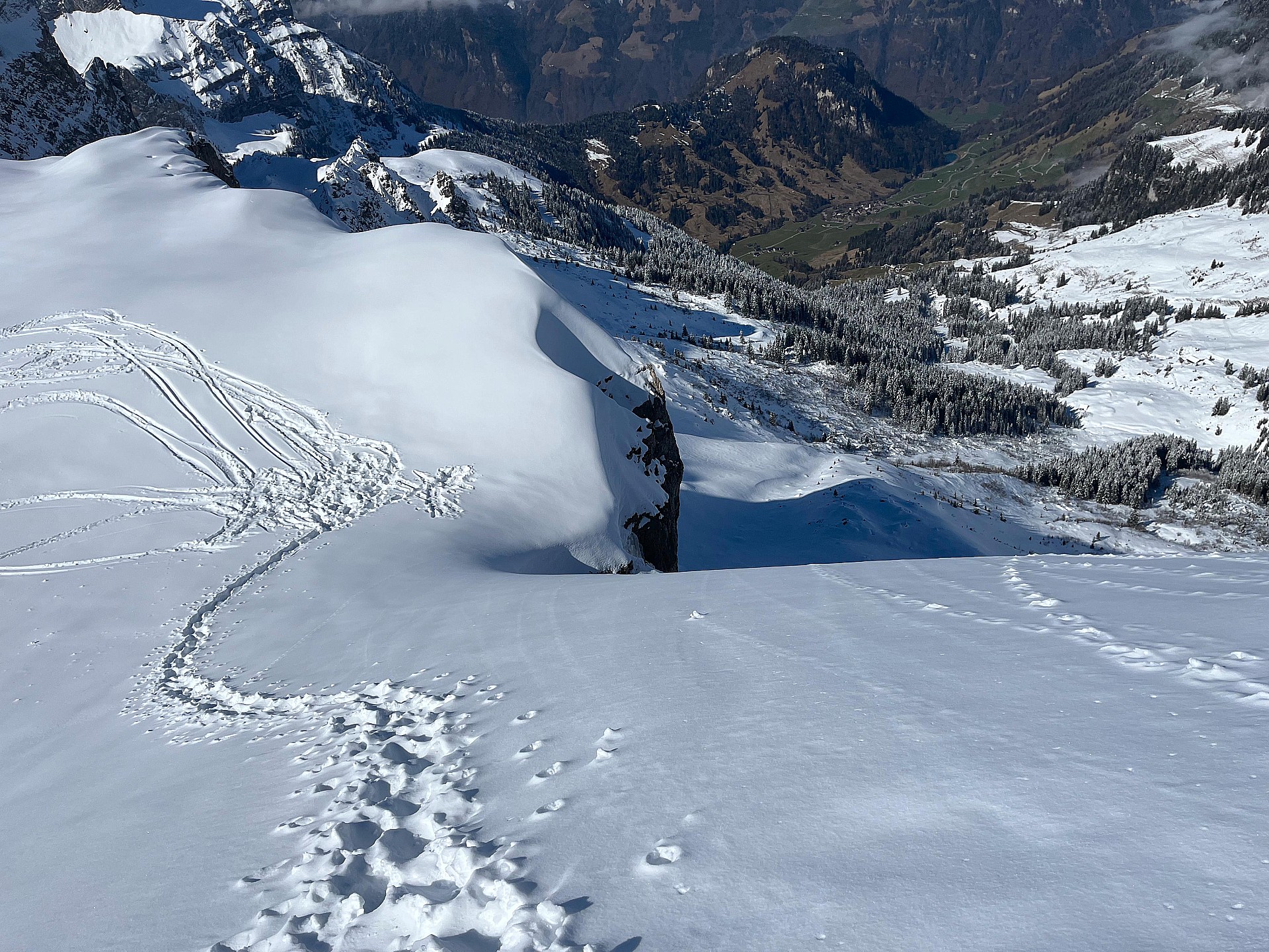 A convinient platform for repacking and putting crampons on. Altitude 2213m.
 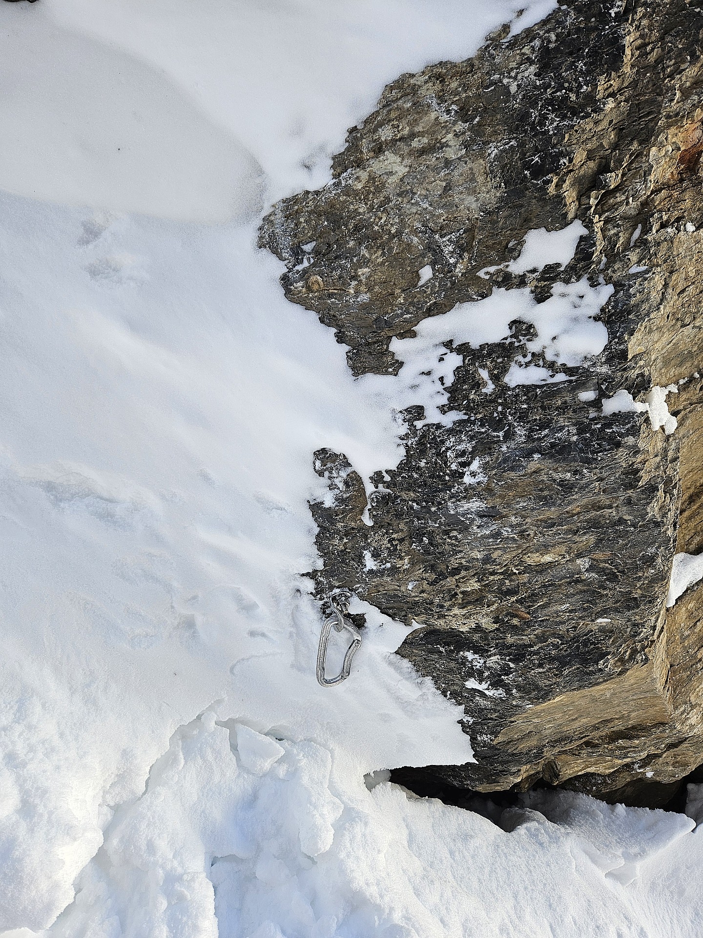 The bolt on the left wall. I suspect with less snow it can be usefull.
 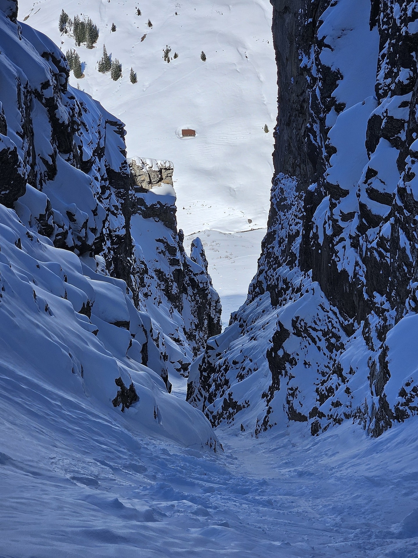 The majesty of the couloir in its entirety.
 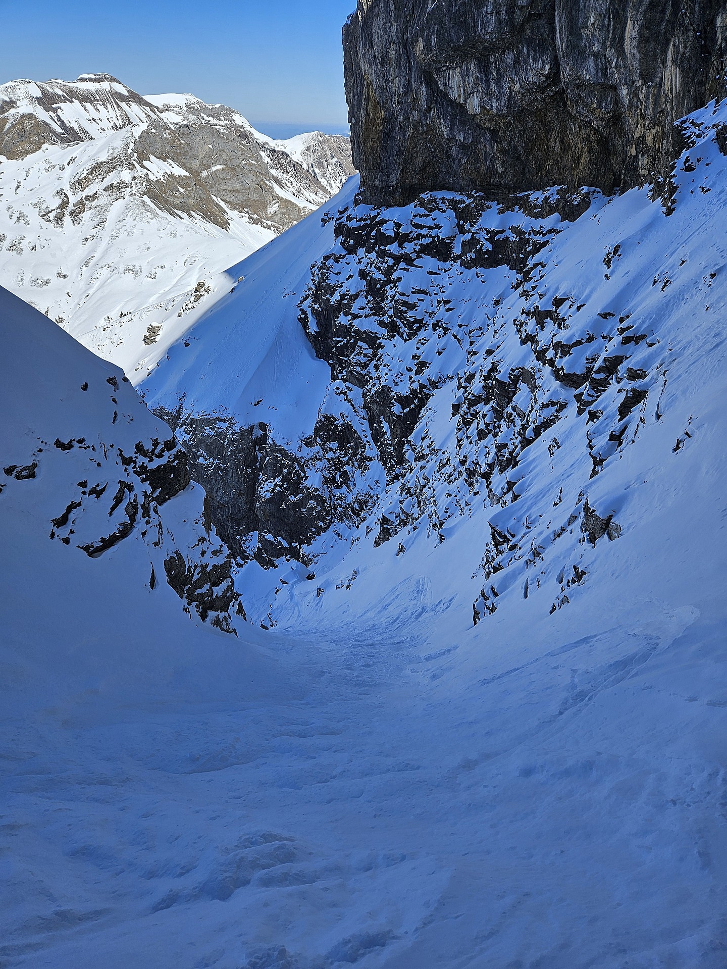 The entry to the couloir.
 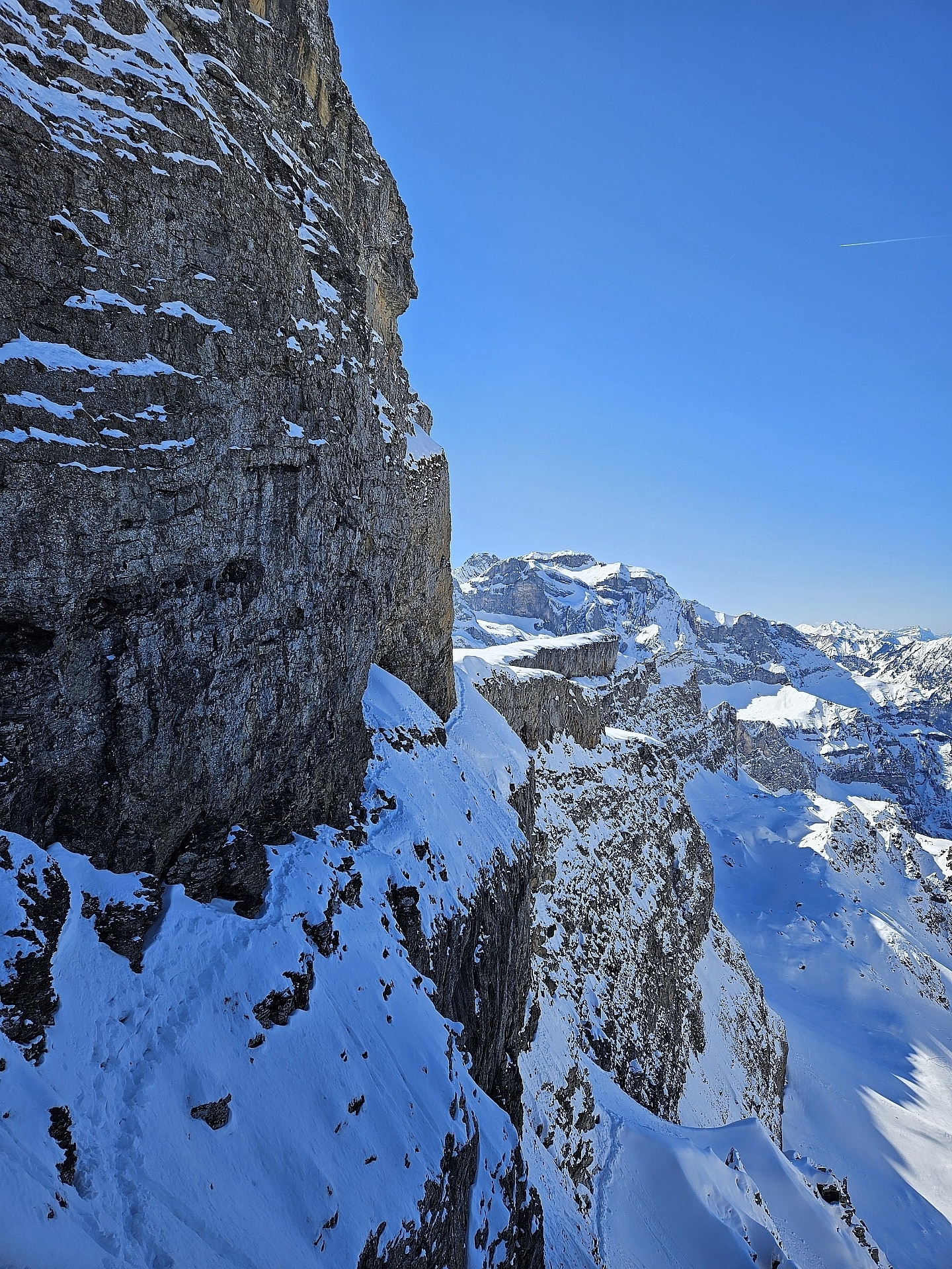 A view from the traverse in its entorety, taken from point 2229.
 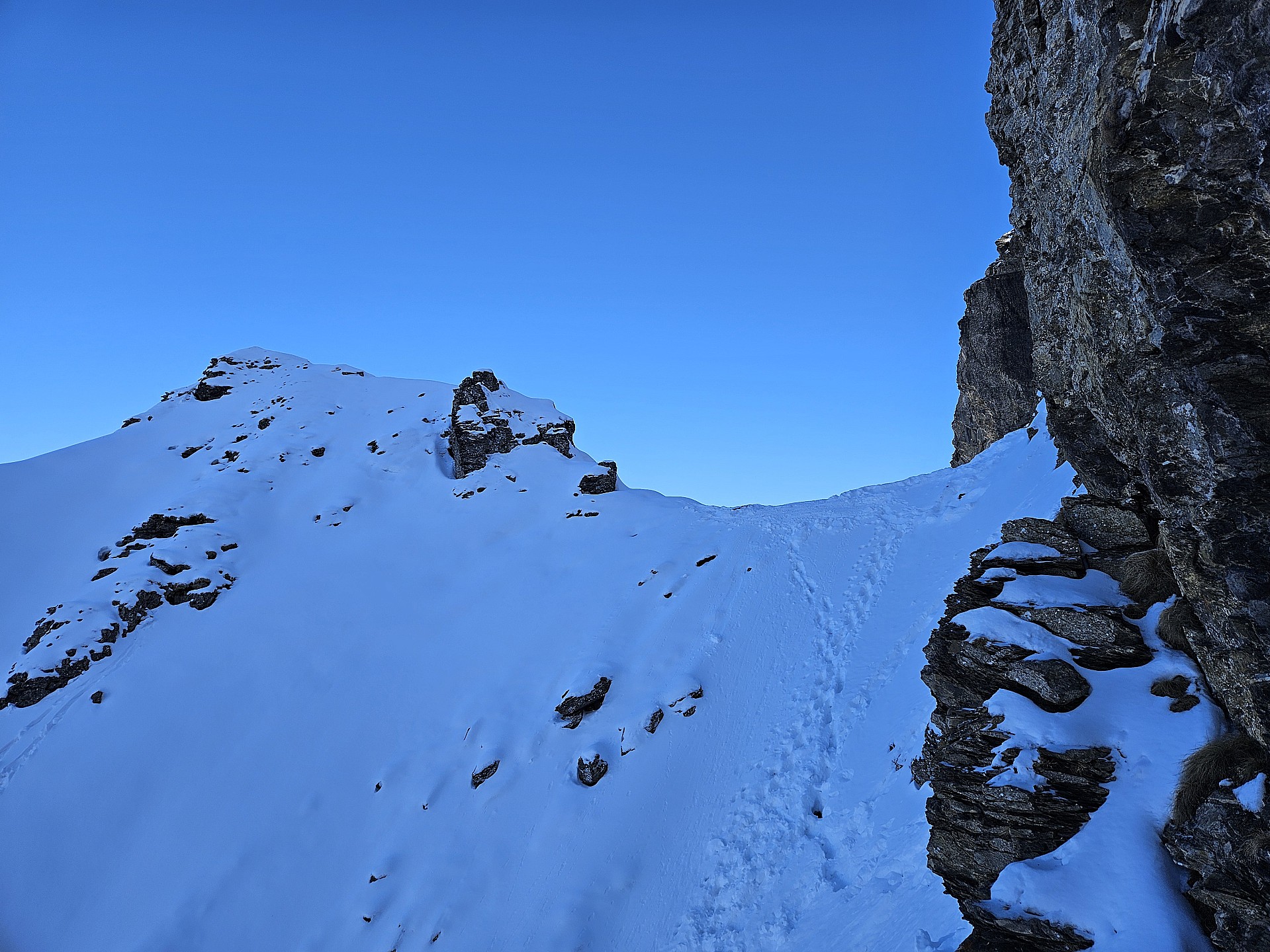 First view to point 2229m.
 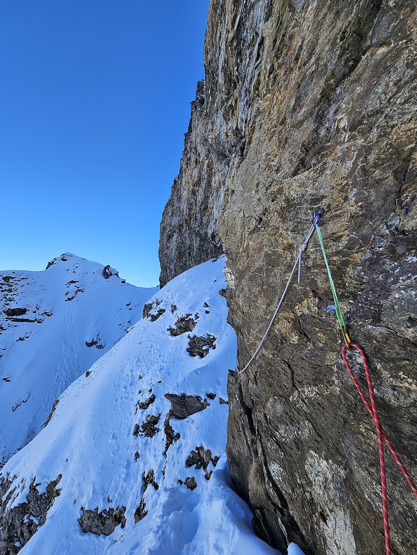 I suspect those are the bolts for the first rappel. We used those to secure the traverse.
  Entering the dreaded traverse.
 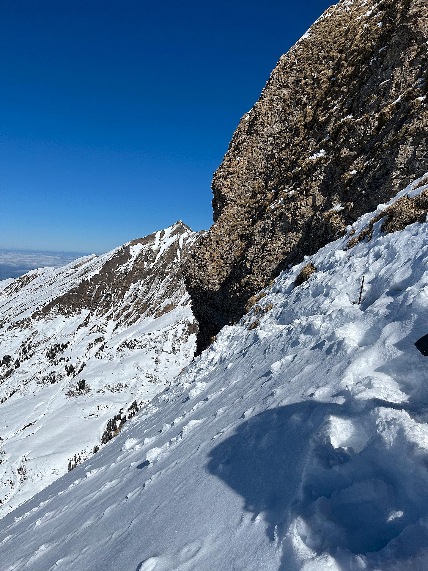 First anchor to reach the rappeling points or entry into the traverse. 5 to 10m above the platform.
  A view from the bottom. Such a nice couloir !


 Pour soutenir Skitour, faites le bon choix